December 4, 2024
The Ebiil Society: Champions of Palau
Ann Singeo, founder of our partner organization the Ebiil Society, shares her vision for a thriving Palau and a flourishing world of indigenous science!
We use cookies to help you navigate efficiently and perform certain functions. You will find detailed information about all cookies under each consent category below.
The cookies that are categorized as "Necessary" are stored on your browser as they are essential for enabling the basic functionalities of the site. ...
Necessary cookies are required to enable the basic features of this site, such as providing secure log-in or adjusting your consent preferences. These cookies do not store any personally identifiable data.
Functional cookies help perform certain functionalities like sharing the content of the website on social media platforms, collecting feedback, and other third-party features.
Analytical cookies are used to understand how visitors interact with the website. These cookies help provide information on metrics such as the number of visitors, bounce rate, traffic source, etc.
Performance cookies are used to understand and analyze the key performance indexes of the website which helps in delivering a better user experience for the visitors.
Advertisement cookies are used to provide visitors with customized advertisements based on the pages you visited previously and to analyze the effectiveness of the ad campaigns.
Looking to make an impact this Earth Month? Here’s how.

As global temperatures continue to rise, the consequences of climate change are becoming more apparent. Scientists can collect data on the rates at which ecosystems are changing to gain insight into the effects of climate change, and then apply their findings to infer what ecosystems may look like in the future. However, this can be an incredibly daunting task for a scientist, considering the dynamic nature of the environment. On-the-ground observation alone is not always enough to effectively monitor a given environment’s rate of change–this is where drones come in.
Drones have become increasingly popular for recreational use, but entertainment is not their only application. Some organizations use drone technology as a resource for conservation efforts. Drone expert and main editor of the blog MyDroneLab Jack Brown has identified several organizations that are working to monitor climate change impacts with drones.
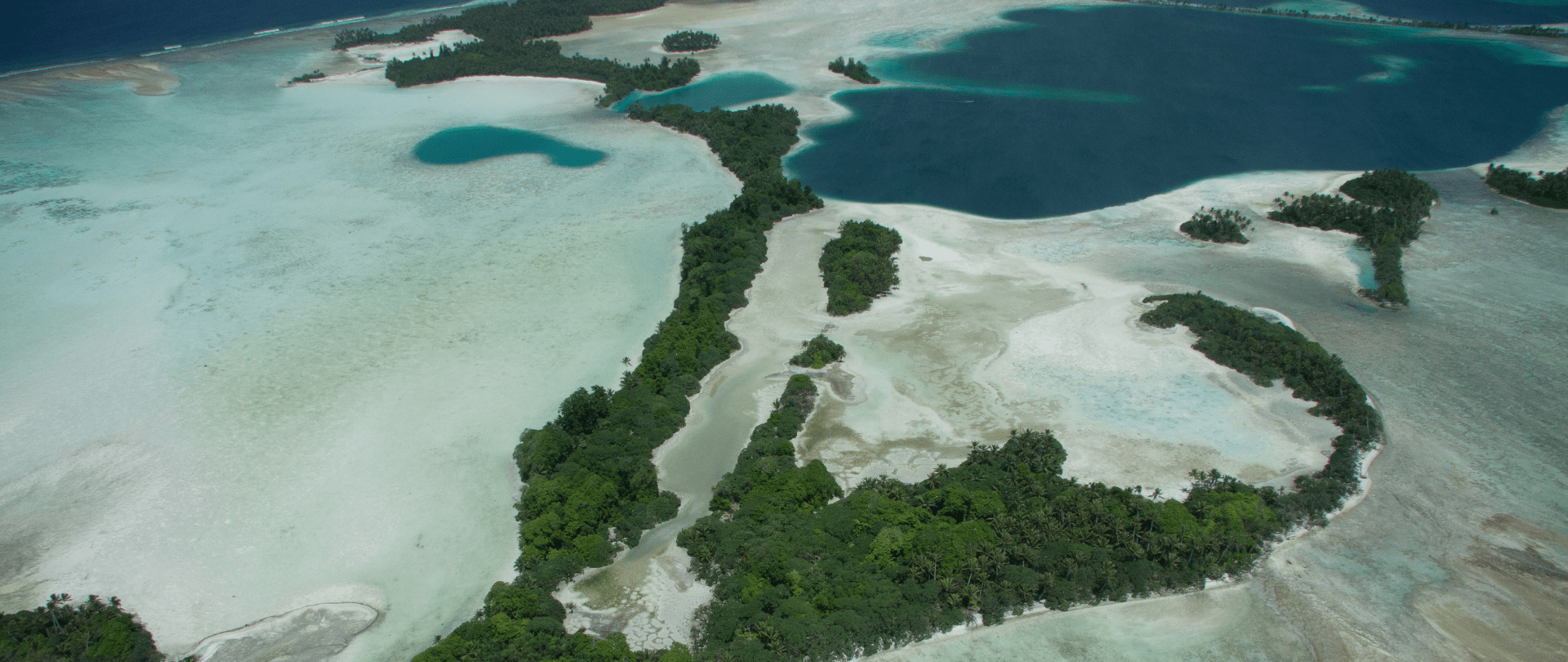
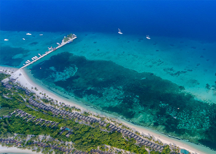
Maldives: mapping sea level rise
Sea level rise is the everyday reality for this island nation. Citizens must consider the risk of flooding every day. A project to create a 3D map of the Maldives was initiated by an agency within the United Nations Development Programme who joined forces with DJI, a leading drone manufacturer. Using drones, they were able to map the island nation in a few months, a task that would normally have taken years. Time is of the essence in the Maldives, where 80% of the islands are threatened with submersion. Brown commented:
This 3D map will save the lives of the 160 people that inhabit these islands should the worst ever occur
The people of the Maldives now have the resources they need to quickly and safely respond to flooding.
Polar ice caps, sea ice, and the Ferpecle Glacier in Valais Switzerland are currently melting due to global temperature rise. Mapping the degradation of glaciers has proven to be an important way to measure the rate of climate change, however scientists find it difficult to keep up with the melting ice. Sensefly, a Swiss climate change group, created the “eBee” drone in order to gain high resolution footage of the progression of melting ice on the Ferpecle Glacier. Brown elaborated:
Areas within the Swiss Alps are now monitored for a couple of hours of the day periodically throughout the year to see how fast changes are happening, exactly where they are happening, and where the movement is coming and going from.
The data collected from the eBee contribute to scientific models glacial melting rates that can be applied globally.
Considering the high resolution capture, the convenience of a compact design, and the semi-autonomous programming, drones are a valuable asset. These organizations have successfully integrated drone technology, and other agencies have already begun to follow suit.
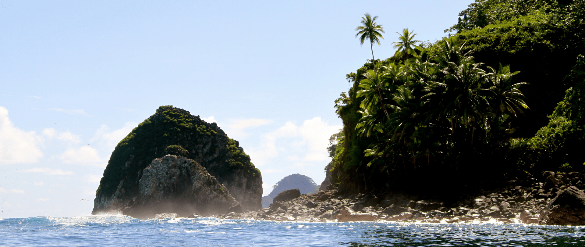
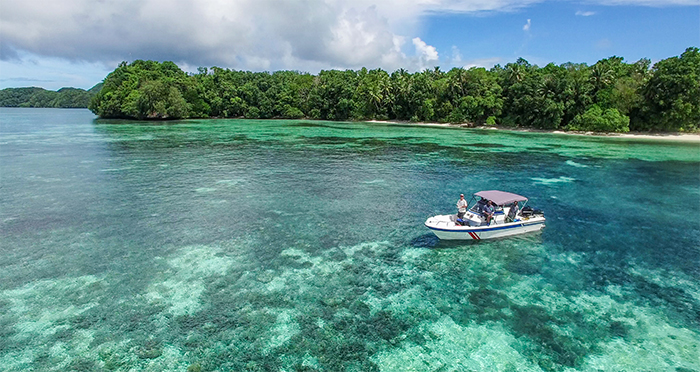
Island Conservation uses drones to survey island ecosystems and capture aerial footage. The aerial perspectives provided by drones offer excellent opportunities to observe vegetation growth on islands.

New applications for drones are sure to come and offer hope for enhanced protection of the natural world.
Featured photo: Drone imagery of Ngeanges, Palau. Credit: Tommy Hall/Island Conservation
Source: Triple Pundit
Check out other journal entries we think you might be interested in.

December 4, 2024
Ann Singeo, founder of our partner organization the Ebiil Society, shares her vision for a thriving Palau and a flourishing world of indigenous science!
November 22, 2024
This historic agreement aims to protect the marine and coastal areas of the Southeast Pacific.
November 18, 2024
Our projects to restore key islets in Nukufetau Atoll forecast climate resilience and community benefits in Tuvalu!
Notifications